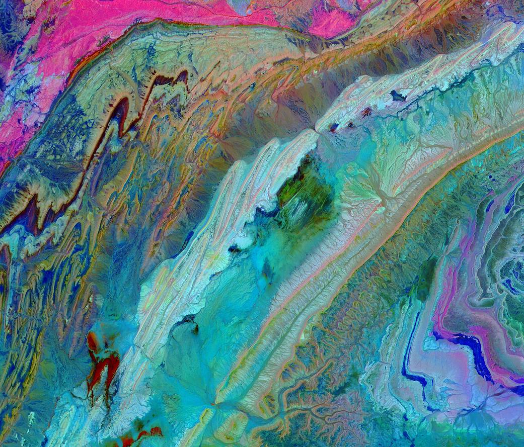
The Anti-Atlas Mountains of Morocco formed as a result of the collision of the African and Eurasian tectonic plates about 80 million years ago. This collision destroyed the Tethys Ocean. The limestone, sandstone, claystone and gypsum layers that formed the ocean bed were folded and crumpled to create the Anti-Atlas Mountains. In this image of southwest Morocco, visible, near infrared and short wavelength infrared bands are combined to dramatically highlight the different rock types, and illustrate the complex folding. The image was acquired on November 5, 2007, by the ASTER instrument on the Terra satellite.
Terra launched 20 years ago in December 1999, beginning a new era in the study of Earth. Terra, flagship of the agency’s Earth Observing System, was built to last for six years and 30,000 orbits. But, 20 years later Terra and its five onboard instruments continue on a mission of discovery, providing data about the planet we call home.
Image Credit: NASA/METI/AIST/Japan Space Systems, and U.S./Japan ASTER Science Team
大约八千万年前,非洲和欧亚构造板块的碰撞形成了摩洛哥的小阿特拉斯山脉。这次碰撞摧毁了特提斯海洋,形成海底的石灰岩、砂岩、粘土和石膏层被折叠和揉皱,形成了小阿特拉斯山脉。在这张摩洛哥西南部的照片中,可见光、近红外波段和短波长的红外波段被结合在一起,显著地突出了不同的岩石类型,并展示了复杂的褶皱。这幅图像是2007年11月5日由Terra卫星上的ASTER仪器拍摄的。
Terra于20年前的1999年12月发射升空,开启了地球研究的新纪元。Terra是该机构地球观测系统的旗舰,其使用寿命长达6年,运行了30,000个轨道。但是20年后,Terra及其五种机载仪器继续执行发现任务,提供了我们称为地球的行星的数据。
图片来源:NASA/METI/AIST/Japan Space Systems, and U.S./Japan ASTER Science Team

