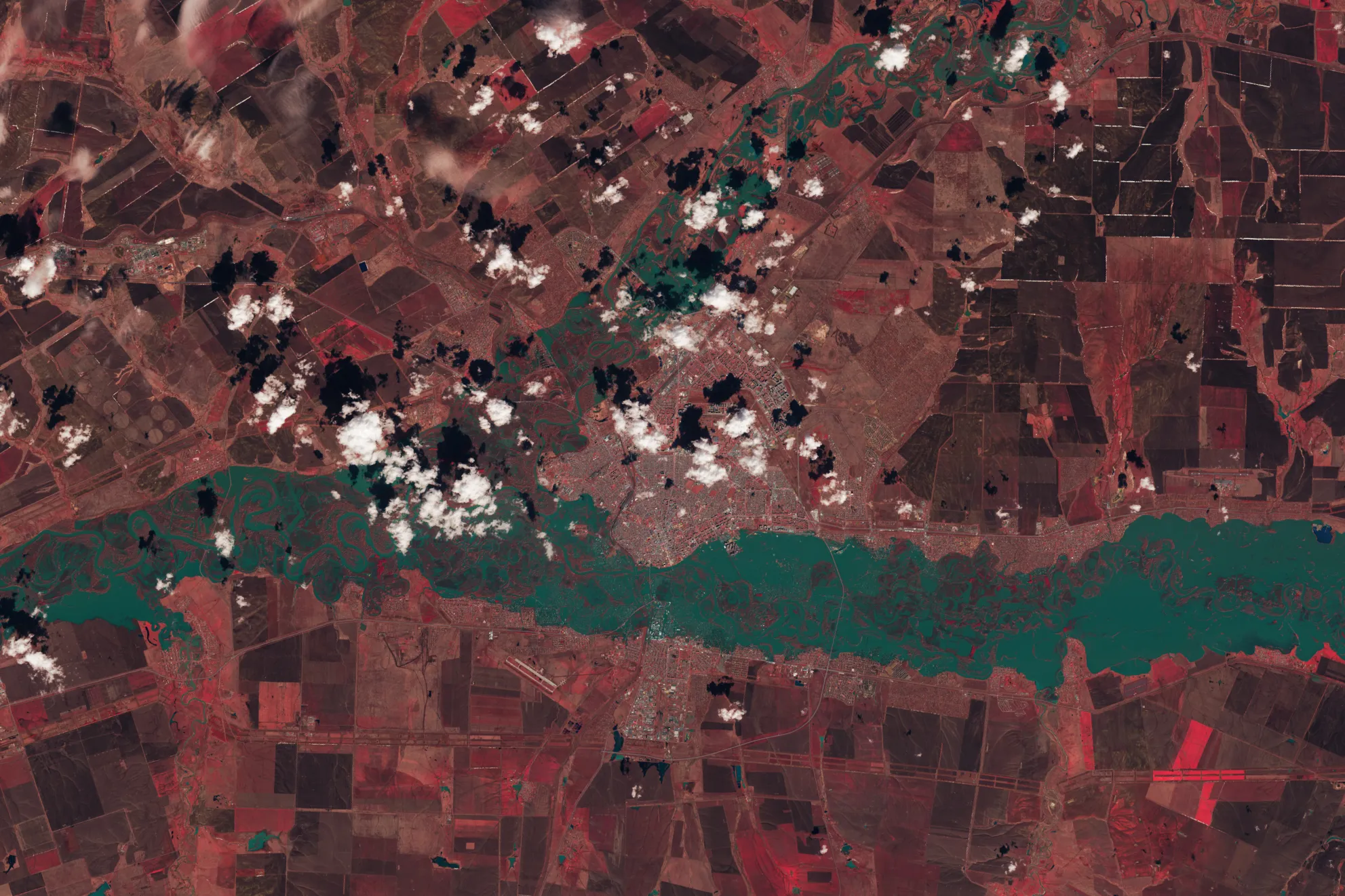
Rivers swelled in southern Russia and northern Kazakhstan in April 2024 following heavy rain and rapid snowmelt. This image shows Orenburg on April 13, the day river levels peaked. This scene was acquired by the OLI-2 (Operational Land Imager) on Landsat 9.
NASA/Michala Garrison, USGS
Ural River levels peak in this April 13, 2024, enhanced color image from Landsat 9; here, vegetation appears red, while water is blue-green. After heavy rain and rapid snowmelt, rivers in southern Russia and northern Kazakhstan swelled, flooding homes and displacing thousands of people.
Landsat 9, the latest satellite in the Landsat series, contributes a critical component to the international strategy for monitoring the health and state of the Earth, allowing more frequent observations. Data from Landsat 9 can be used to inform decisions in key areas like urban expansion, coral reef degradation, and natural disasters.
Image Credit: NASA/Michala Garrison, USGS
2024年4月,在大雨和快速融雪之后,俄罗斯南部和哈萨克斯坦北部的河流水位上涨。这张照片显示的是4月13日奥伦堡的情况,当天河水水位达到峰值。这一场景是由陆地卫星9号上的OLI-2(二代陆地成像仪)拍摄。
NASA/Michala Garrison, USGS
乌拉尔河水位在2024年4月13日达到峰值,来自陆地卫星9号的增强彩色图像;这里的植被呈红色,而水呈蓝绿色。在暴雨和快速融雪后,俄罗斯南部和哈萨克斯坦北部的河流水位上涨,淹没了房屋,数千人流离失所。
陆地卫星9号是陆地卫星系列中的最新卫星,它是监测地球健康和状况的国际战略的一个重要组成部分,可以进行更频繁的观测。来自陆地卫星9号的数据可用于为城市扩张、珊瑚礁退化和自然灾害等关键领域的决策提供信息。
影像来源:NASA/Michala Garrison, USGS

