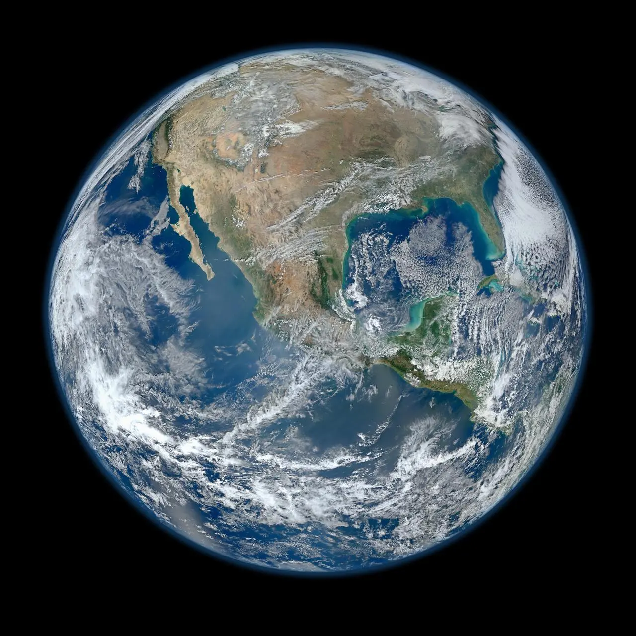
Behold one of the more detailed images of Earth. This Blue Marble Earth montage—created from photographs taken by the Visible/Infrared Imager Radiometer Suite (VIIRS) instrument aboard the Suomi NPP satellite—shows many stunning details of our home planet.
NASA
This Jan. 30, 2012 image of Earth was created from photographs taken by the Visible/Infrared Imager Radiometer Suite (VIIRS) instrument aboard the Suomi NPP satellite. Many features of North America and the Western Hemisphere are particularly visible. The composite was created from the data collected during four orbits of the robotic satellite taken earlier in January 2012 and digitally projected onto the globe.
VIIRS collects visible and infrared imagery along with global observations of Earth’s land, atmosphere, cryosphere, and ocean, extending observational records collected by similar instruments aboard previously launched satellites, such as NASA’s Moderate Resolution Imaging Spectroradiometer (MODIS) and NOAA’s Advanced Very High Resolution Radiometer (AVHRR).
Help us celebrate Earth Day by sharing a #GlobalSelfie.
Image Credit: NASA
请看一张更详细的地球图片。这张蓝色大理石地球蒙太奇照片是由Suomi NPP卫星上的可见光/红外成像仪辐射计套件(VIIRS)拍摄的,展示了我们地球的许多令人惊叹的细节。
NASA
这张2012年1月30日的地球图像是由Suomi NPP卫星上的可见光/红外成像仪辐射计套件(VIIRS)仪器拍摄的照片创建的。北美和西半球的许多特征都特别明显。这张合成照片是根据2012年1月早些时候拍摄的机器人卫星四次轨道运行期间收集的数据制作的,并以数字方式投影到地球上。
VIIRS收集可见光和红外图像,以及对地球陆地、大气层、冰冻圈和海洋的全球观测,扩展了以前发射的卫星上类似仪器收集的观测记录,如NASA的中分辨率成像光谱仪(MODIS)和NOAA的先进的超高分辨率辐射计(AVHRR)。
影像来源: NASA

