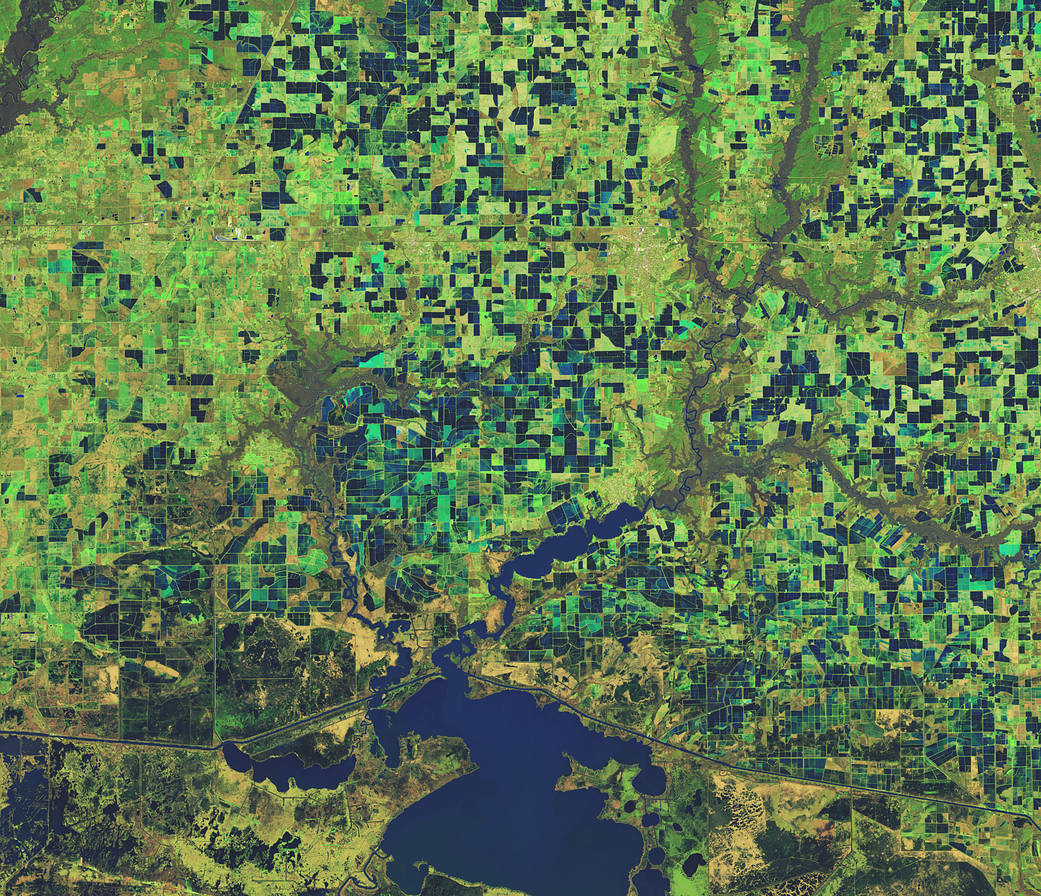
This Feb 3, 2023, enhanced-color image from Landsat 9 highlights a green and blue patchwork pattern in flooded rice fields in southwestern Louisiana. Raised levees used for water management form the grid pattern between the fields, which appear dark blue.
As it flowed through several southern states over tens of thousands of years, the Mississippi River left a valuable layer of fertile soil in its wake. This low-lying floodplain and the flat coastal prairies of Louisiana and Texas are now home to most of the rice farms in the United States. In 2021, Arkansas, Louisiana, Mississippi, and Texas—collectively known as the Rice Belt—produced about 73 percent of all rice in the United States.
Image Credit: NASA
这张2023年2月3日的增强彩色图像来自陆地卫星9号,突出显示了路易斯安那州西南部被洪水淹没的稻田中绿蓝相间的图案。用于水管理的加高的堤坝形成了田地之间的网格图案,呈现深蓝色。
数万年来,密西西比河流经美国南部几个州,留下了一层宝贵的沃土。这片低洼的洪泛平原以及路易斯安那州和德克萨斯州平坦的沿海大草原现在是美国大部分水稻农场的所在地。2021年,阿肯色州、路易斯安那州、密西西比州和德克萨斯州(统称为水稻带)的水稻产量约占美国总产量的73%。
影像来源:NASA

