梅尔克修道院珍藏的天文手稿
请参阅说明。单击图片将下载可用的最高分辨率版本。
Woody Hoburg took this photo of Laguna Verde’s inviting waters as the International Space Station orbited 264 miles (425 km) over South America on July 7, 2023. Laguna Verde, which has an altitude of over 14,000 feet (4,300 meters), is located in the Andes mountains of Chile. Even taller landmarks surround the high-altitude lake, including Ojos del Salado—th...
As sunlight and warmth increase in the spring and summer, the North Sea starts to gain swirls and tendrils of color. Phytoplankton—tiny, plant-like organisms that often float near the ocean surface—become abundant during this time, giving the shallow water the distinctive look seen in this June 14, 2023, image from Landsat 9. Phytoplankton turn sunlight and ...
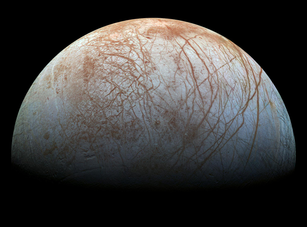
2023年5月20日 Galileo’s Europa Image Credit: NASA, JPL-Caltech, SETI Institute, Cynthia Phillips, Marty Valenti Explanation: Looping through the Jovian system in the late 1990s, the Galileo spacecraft recorded stunning views of Europa and uncovered evidence that the moon’s icy surface likely hides a deep, global ocean. Galileo’s Europa image d...
OPERA可以整合来自多颗卫星的数据,帮助政府机构、灾难应急人员和公众获取关于自然和人类对土地影响的数据。
Floodwater (dark blue) stands out against the vegetation in agricultural fields around Tulare Lake near Corcoran, California, in this enhanced color image taken by Landsat 8 on March 29, 2023. Heavy rain and snow in the first three months of 2023 have once again brought water to Tulare’s lakebed, but also flooding several nearby towns. 2023 has been the wett...
Phytoplankton create rich blooms of color in the Atlantic Ocean near South America in this enhanced color image from Dec. 2, 2014. The Patagonian Shelf Break is a biologically rich patch of ocean where airborne dust from the land, iron-rich currents from the south, and upwelling currents from the depths provide a bounty of nutrients for phytoplankton. The ba...
This Feb 3, 2023, enhanced-color image from Landsat 9 highlights a green and blue patchwork pattern in flooded rice fields in southwestern Louisiana. Raised levees used for water management form the grid pattern between the fields, which appear dark blue. As it flowed through several southern states over tens of thousands of years, the Mississippi River left...
The Surface Water and Ocean Topography (SWOT) spacecraft is seen in this early morning photo from Dec. 14, 2022, as preparations for launch continued. SWOT, the first satellite mission that will observe nearly all water on Earth’s surface, launched on Dec. 16. Jointly developed by NASA and Centre National D’Études Spatiales, with contributions from the Canad...