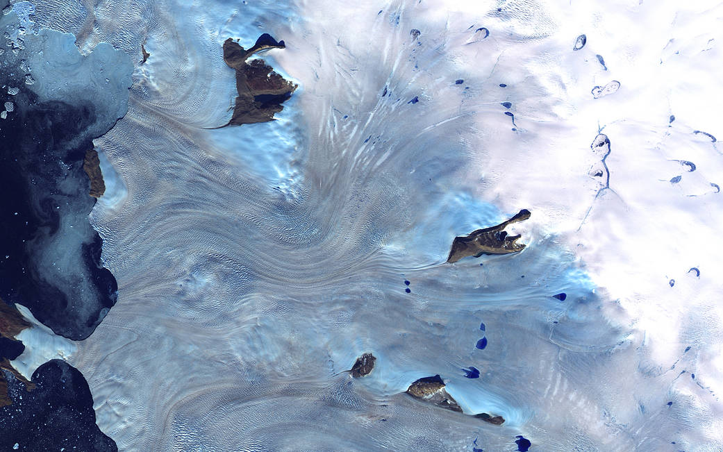
Acquired by the Landsat 7 satellite more than 20 years ago on Sept. 3, 2000, this image is of Greenland’s western coast and the small field of glaciers that surrounds Baffin Bay. This is a false-color composite image made using near-infrared, red, and blue wavelengths.
20多年前的2000年9月3日,陆地卫星7号拍摄了这张照片,这是格陵兰岛的西海岸和环绕巴芬湾的小块冰川区域。这是一张使用近红外、红色和蓝色波长制作的假彩色合成图像。
NASA continues to monitor the planet we call home. Landsat 9, the latest in the series of Landsat Earth-monitoring satellites, is a partnership between NASA and the U.S. Geological Survey that will continue the program’s critical role in monitoring, understanding, and managing the land resources needed to sustain human life. The mission is slated to launch later in 2021.
美国航天局继续监测我们称之为家园的星球。陆地卫星9号是美国陆地卫星计划中最新的一颗地球监测卫星,是NASA和美国地质调查局之间的合作项目,它将继续发挥该计划在监测、了解和管理维持人类生活所需的土地资源方面的关键作用。该任务预计在2021年晚些时候发射。
Image Credit: U.S. Geological Survey EROS Data Center Satellite Systems Branch
影像来源:美国地质调查局EROS数据中心卫星系统处

