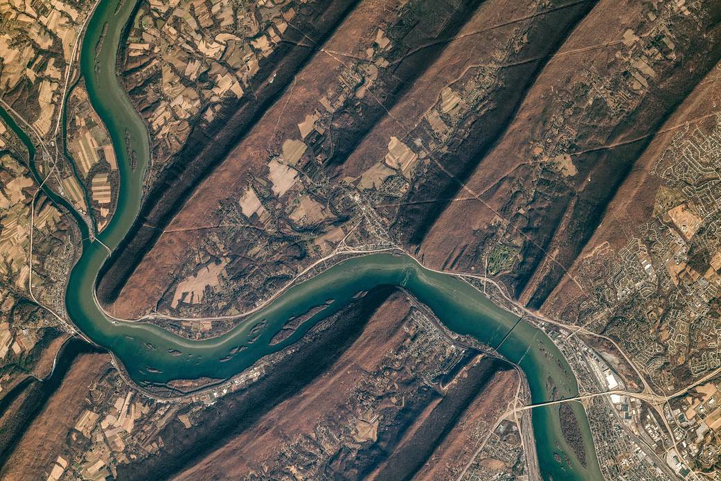
The Susquehanna River cuts through the folds of the Valley-and-Ridge province of the Appalachian Mountains in this photograph taken by the crew of the International Space Station.
The Valley-and-Ridge province is a section of the larger Appalachian Mountain Belt between the Appalachian Plateau and the Blue Ridge physiographic provinces. The northeast-southwest trending ridges are composed of Early Paleozoic sedimentary rocks. The valleys between them were made of softer rocks (limestone and shales) that were more susceptible to erosion; they are now occupied by farms. The Susquehanna River cuts through several ridges as it flows south.
The Susquehanna River flows 444 mi (714 kilometers) from upstate New York to Maryland, draining into Chesapeake Bay.
Fifty years ago, on April 22, 1970, people around the world marked the first Earth Day. On this Earth Day, as we physically separate ourselves by necessity, we can still collectively appreciate the wondrous beauty of our planet and the extraordinary science that helps us understand how it all works – and we can do it from our homes.
Follow along this week as we celebrate #EarthDayAtHome with NASA.
Image Credit: NASA/Expedition 61; Caption by Laura Phoebus, Jacobs, JETS Contract at NASA-JSC
在这张由国际空间站的工作人员拍摄的照片中,萨斯奎哈那河穿过阿巴拉契亚山脉的岭谷区。
岭谷区是阿巴拉契亚高原和蓝岭自然地理省之间较大的阿巴拉契亚山脉带的一部分。东北-西南向脊由早古生代沉积岩组成。它们之间的山谷是由较软的岩石(石灰石和页岩)构成的,更容易受到侵蚀;他们现在被农场占用了。萨斯奎哈纳河向南流经多条山脊。
萨斯奎哈纳河从纽约州北部流向马里兰州,全长444英里(714公里),流入切萨皮克湾。
50年前,1970年4月22日,世界各地的人们庆祝了第一个地球日。今年的世界地球日,即使疫情之下人们不得不彼此隔离,我们仍能一同欣赏地球奇绝的美丽,以及吸引了一代代科学家不断探索的深刻科学,而如今,我们呆在家里就能借用这些科学了解地球运作的方式。
本周跟随我们与美国国家航空航天局(NASA)一起庆祝#EarthDayAtHome。
图片来源:NASA/Expedition 61; Caption by Laura Phoebus, Jacobs, JETS Contract at NASA-JSC


翡翠色太迷人了