Stretching from tropical Florida to the doorstep of Europe, the Gulf Stream carries a lot of heat, salt and history. This river of water is an important part of the global ocean conveyor belt, moving water and heat from the Equator toward the far North Atlantic. It is one of the strongest currents on Earth and one of the most studied. Its discovery is often attributed to Benjamin Franklin, though sailors likely knew about the current long before they had a name for it.
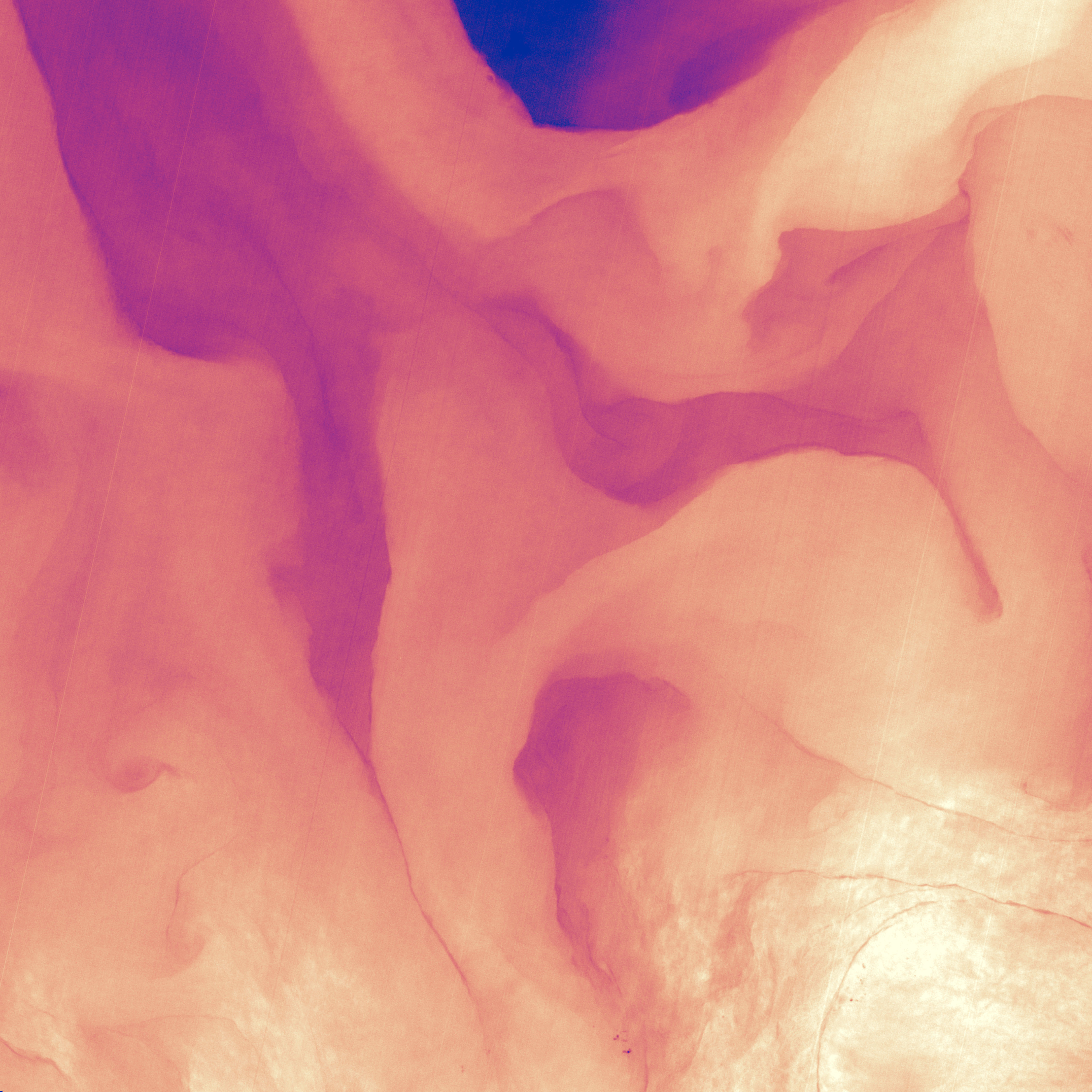
This image shows a small portion of the Gulf Stream off of South Carolina as it appeared in infrared data collected by the Landsat 8 satellite in April 2013. Colors represent the energy—heat—being emitted by the water, with cooler temperatures in purple and the warmest water being nearly white. Note how the Gulf Stream is not a uniform band but instead has finer streams and pockets of warmer and colder water.
See this and other amazing images of the planet we call home.
Fifty years ago, on April 22, 1970, people around the world marked the first Earth Day. On this Earth Day, as we physically separate ourselves by necessity, we can still collectively appreciate the wondrous beauty of our planet and the extraordinary science that helps us understand how it all works – and we can do it from our homes.
Follow along this week as we celebrate #EarthDayAtHome with NASA.
墨西哥湾流从热带的佛罗里达一直延伸到欧洲的家门口,它携带着大量的热量、盐分和历史。这条湾流是全球海洋传送带的重要组成部分,将水和热量从赤道输送到遥远的北大西洋。它是地球上最强的湾流之一,也是研究最多的湾流之一。它的发现通常被认为是本杰明·富兰克林的功劳,尽管水手们可能早在给它起名字之前就知道了。
这幅图像显示了南卡罗莱纳湾流的一小部分,它出现在2013年4月由陆地卫星8号收集的红外数据中。颜色代表水散发出的能量——热量,温度较低的水呈紫色,温度较高的水几乎呈白色。请注意,墨西哥湾暖流不是一个均匀的带状,而是有更细的溪流和更暖和更冷的水域。
50年前,1970年4月22日,世界各地的人们庆祝了第一个地球日。今年的世界地球日,即使疫情之下人们不得不彼此隔离,我们仍能一同欣赏地球奇绝的美丽,以及吸引了一代代科学家不断探索的深刻科学,而如今,我们呆在家里就能借用这些科学了解地球运作的方式。
本周跟随我们与NASA一起庆祝#EarthDayAtHome。

