Fifty years ago, on April 22, 1970, people around the globe marked the first Earth Day. On this Earth Day, as we physically separate ourselves by necessity, we can still collectively appreciate the wondrous beauty of our planet and the extraordinary science that helps us understand how it all works – and we can do it from our homes.
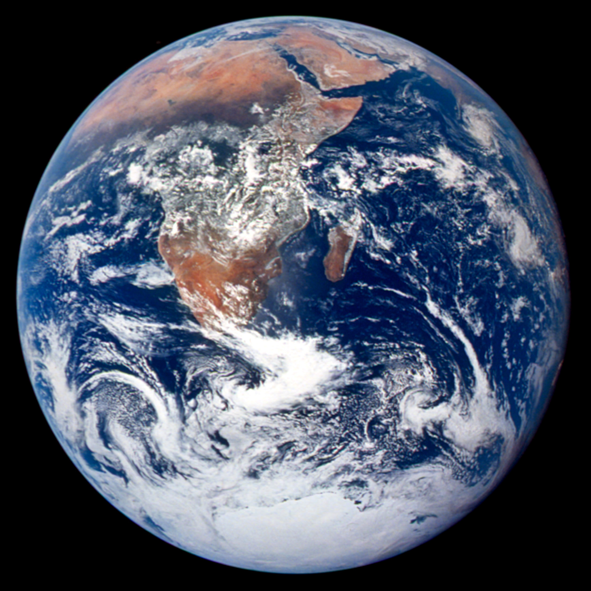
This classic photograph of the Earth was taken on Dec. 7, 1972, by the crew of Apollo 17. The original caption is reprinted below:
View of the Earth as seen by the Apollo 17 crew traveling toward the moon. This translunar coast photograph extends from the Mediterranean Sea area to the Antarctica south polar ice cap. This is the first time the Apollo trajectory made it possible to photograph the south polar ice cap. Note the heavy cloud cover in the Southern Hemisphere. Almost the entire coastline of Africa is clearly visible. The Arabian Peninsula can be seen at the northeastern edge of Africa. The large island off the coast of Africa is the Malagasy Republic. The Asian mainland is on the horizon toward the northeast.
Astronaut photograph AS17-148-22727 from NASA Johnson Space Center Gateway to Astronaut Photography of Earth
Our astronauts still make observations of Earth from space. Learn more: The Combined Power of Remote Earth Observations aboard the International Space Station.
Follow along this week as we celebrate #EarthDayAtHome with NASA.
Image Credit: NASA
50年前,1970年4月22日,世界各地的人们庆祝了第一个地球日。今年的世界地球日,即使疫情之下人们不得不彼此隔离,我们仍能一同欣赏地球奇绝的美丽,以及吸引了一代代科学家不断探索的深刻科学,而如今,我们呆在家里就能借用这些科学了解地球运作的方式。
这张经典的地球照片摄于1972年12月7日,由阿波罗17号的宇航员拍摄。原文转载如下:
阿波罗17号宇航员向月球旅行时所看到的地球景观。这张跨越月球海岸的照片从地中海地区一直延伸到南极南极冰盖。这是阿波罗轨道第一次使拍摄南极冰盖成为可能。注意南半球的厚云层覆盖。几乎整个非洲的海岸线都清晰可见。阿拉伯半岛位于非洲的东北部。非洲海岸外的大岛是马达加斯加共和国。亚洲大陆在东北方向的地平线上。
从NASA约翰逊太空中心到地球宇航员摄影的照片AS17-148-22727
我们的宇航员仍在太空中观察地球。了解更多:国际空间站上的远程地球观测的综合能力。
本周跟随我们与NASA一起庆祝#EarthDayAtHome。
图片来源:NASA

