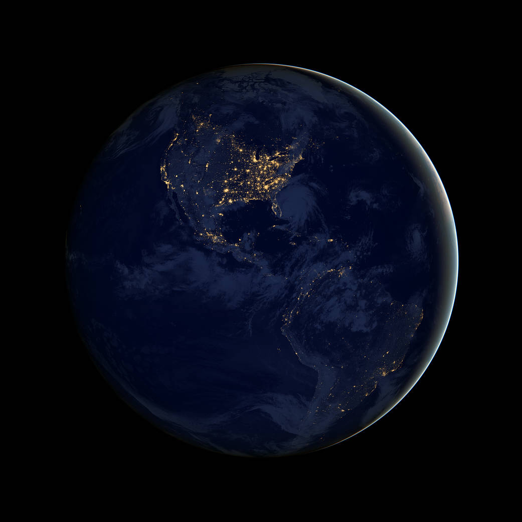
This image of North and South America at night is a composite assembled from data acquired by the Suomi NPP satellite in April and October 2012. The new data was mapped over existing Blue Marble imagery of Earth to provide a realistic view of the planet.
For more such images of our planet, read Earth at Night, NASA’s latest ebook that features dazzling photographs and images from space of Earth’s nightlights. For nearly 25 years, satellite images of Earth at night have served as a fundamental research tool, while also stoking public curiosity. The images paint an expansive and revealing picture, showing how humans have illuminated and shaped the planet in profound ways since the invention of the light bulb 140 years ago.
This image’s striking nighttime view was made possible by Suomi’s “day-night band” of the Visible Infrared Imaging Radiometer Suite. VIIRS detects light in a range of wavelengths from green to near-infrared and uses filtering techniques to observe dim signals such as city lights, gas flares, auroras, wildfires and reflected moonlight. In this case, auroras, fires and other stray light have been removed to emphasize the city lights.
Image Credit: NASA
这张北美和南美夜间的图像是由Suomi NPP卫星在2012年4月和2012年10月获得的数据合成而成的。新数据被映射到现有的地球蓝色弹珠图像上,以提供地球的真实视图。
有关我们地球的更多此类图像,请阅读美国国家航空航天局最新出版的电子书《地球之夜》,书中收录了地球夜间灯光下的令人眼花缭乱的照片和图像。近25年来,地球夜间卫星图像一直是一种基础研究工具,同时也激发了公众的好奇心。这些图像描绘了一幅广阔而又发人深省的画面,展示了自140年前灯泡发明以来,人类如何以深远的方式照亮和塑造这个星球。
Suomi的“可见红外成像辐射计套件”的“日夜波段”使这张照片具有惊人的夜间视野。VIIRS可以检测从绿色到近红外的各种波长的光,并使用过滤技术来观察微弱的信号,如城市灯光、气体耀斑、极光、野火和反射的月光。在这种情况下,极光、火灾和其他杂散光被移除了,以强调城市灯光。
影像来源:NASA

