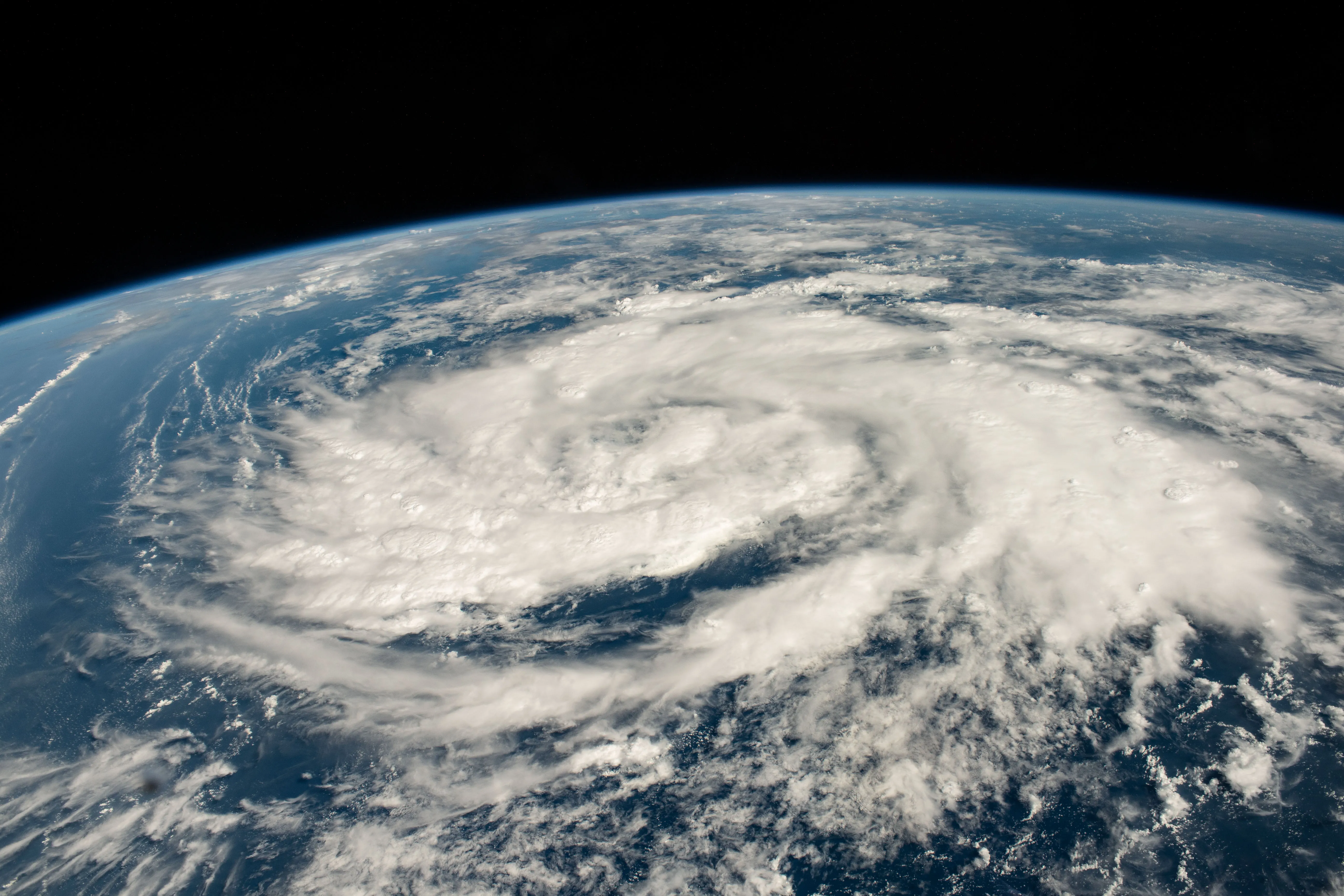
A storm is pictured in the Arabian Sea less than 700 miles off the coast of Oman as the International Space Station orbited 260 miles above.
NASA / Jasmin Moghbeli
While the International Space Station orbited 260 miles above Earth on Oct. 20, 2023, astronaut Jasmin Moghbeli snapped this image of a storm in the Arabian Sea, less than 700 miles off the coast of Oman. In addition to photographing our planet from the space station, NASA also observes Earth with satellites. These satellites collect data on storms that scientists can then use to create near real-time products to support disaster response.
For example, NASA and JAXA’s (Japan Aerospace Exploration Agency) Global Precipitation Measurement (GPM) satellite frequently observes the structure of precipitation within tropical cyclones and hurricanes, and the Integrated Multi-Satellite Retrievals for GPM product maps their intense rainfall rates over time to provide situational awareness for potential flood events. Following landfall, optical data collected by the Aqua, Terra, Landsat, or Suomi NPP satellites can map the extent and severity of flooding – and should clouds obscure the region, SAR data from ESA Sentinel satellites or NASA Airborne Science instruments can also be used to detect flooding. In addition to giving insights into how storms form and intensify, NASA satellites also supply key inputs to weather models to help generate life-saving forecasts.
Image Credit: NASA/Jasmin Moghbeli
这张照片拍摄于距离阿曼海岸不到700英里的阿拉伯海,当时国际空间站正在距阿曼海岸260英里的轨道上运行。
NASA / Jasmin Moghbeli
2023年10月20日,当国际空间站在地球上空260英里的轨道上运行时,宇航员贾斯敏·莫格贝利在距离阿曼海岸不到700英里的阿拉伯海拍下了这张风暴的照片。除了从空间站拍摄我们的星球,NASA还用卫星观察地球。这些卫星收集有关风暴的数据,然后科学家可以使用这些数据来创建近乎实时的产品,以支持灾难响应。
例如,NASA和和JAXA(日本宇宙航空研究开发机构)的全球降水测量(GPM)卫星经常观测热带气旋和飓风中的降水结构,GPM产品的综合多卫星检索绘制了其随时间推移的强降雨率,以提供对潜在洪水事件的态势感知。登陆后,AQUA、Terra、Landsat或Suomi NPP卫星收集的光学数据可以绘制洪水的范围和严重程度——如果云层遮住了该地区,欧空局哨兵卫星或NASA机载科学仪器的SAR数据也可以用于检测洪水。除了提供风暴如何形成和增强的见解,NASA卫星还为天气模型提供关键输入,以帮助生成拯救生命的预测。
影像来源: NASA/Jasmin Moghbeli

