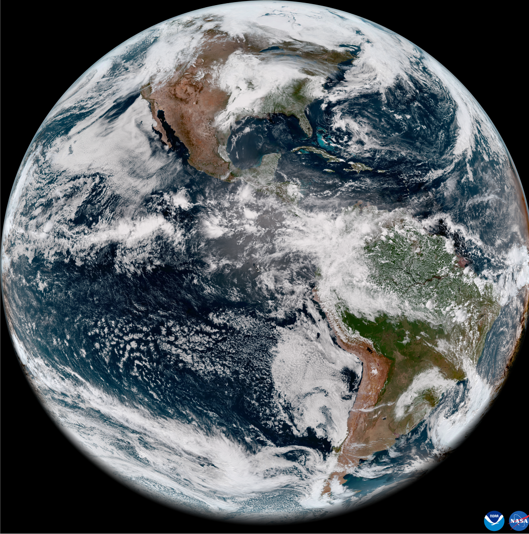
On May 11, 2022, the National Oceanic and Atmospheric Administration, or NOAA, shared the first images of the Western Hemisphere from its Geostationary Operational Environmental Satellite-T (GOES-T). Later designated GOES-18, the satellite’s Advanced Baseline Imager (ABI) instrument recently captured stunning views of Earth.
Launched by NASA on March 1, GOES-18 lifted off at 4:38 p.m. EST from Cape Canaveral Space Force Station’s Space Launch Complex 41 in Florida. The ABI views Earth with 16 different channels, each measuring energy at different wavelengths along the electromagnetic spectrum to obtain information about Earth’s atmosphere, land, and ocean.
Learn more: GOES Overview and History
Image Credit: NOAA
2022年5月11日,美国国家海洋和大气管理局(简称NOAA)分享了其地球同步运行环境卫星-T(GOES-T)拍摄的第一张西半球图像。该卫星的高级基线成像仪(ABI)仪器后来被命名为GOES-18,它最近拍摄到了地球的壮丽景色。
GOES-18由NASA于3月1日发射,于美国东部时间下午4:38从佛罗里达州卡纳维拉尔角空间站的41号空间发射场发射升空。ABI用16个不同的通道观察地球,每个通道测量电磁波谱中不同波长的能量,以获取有关地球大气、陆地和海洋的信息。
了解更多:GOES的概况和历史
影像来源:NOAA

