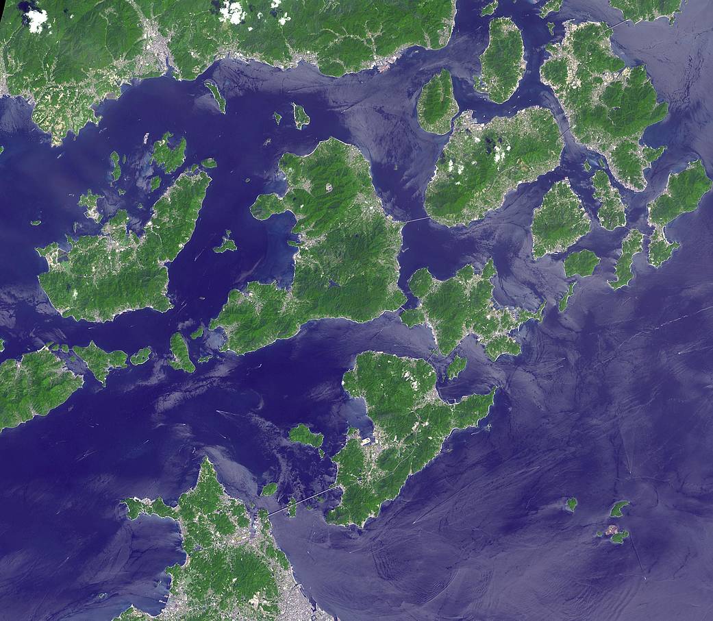
Japan’s Geiyo Archipelago, in the Seito Inland Sea, was once home to pirates. From the 9th to the 16th centuries, the pirates dominated the Inland Sea and terrorized the coasts of East Asia. Until the Shimanami Kaido (Inland Wave Sea Road) was completed in 1999, the Geiyo Islands were a remote region, accessible only by boat.
This ASTER image was acquired Aug. 19, 2010. With its 14 spectral bands from the visible to the thermal infrared wavelength region and its high spatial resolution of about 50 to 300 feet (15 to 90 meters), ASTER images Earth to map and monitor the changing surface of our planet. ASTER is one of five Earth-observing instruments launched Dec. 18, 1999, on Terra. The instrument was built by Japan’s Ministry of Economy, Trade, and Industry. A joint U.S./Japan science team is responsible for validation and calibration of the instrument and data products.
#TBT
Image Credit: NASA/METI/AIST/Japan Space Systems, and U.S./Japan ASTER Science Team
位于濑户内海(Seito Inland Sea)的日本艺予诸岛(Geiyo Archipelago)曾是海盗的家园。从9世纪到16世纪,海盗统治着内陆海,并威胁着东亚沿海地区。在岛波海道于1999年完工之前,艺予诸岛是一个偏远地区,只能乘船前往。
这张ASTER图像拍摄于2010年8月19日。凭借其从可见光到热红外波长区域的 14 个光谱带以及大约 50 到 300 英尺(15 到 90 米)的高空间分辨率,ASTER可以为地球成像,以绘制和监测地球不断变化的表面。ASTER是1999年12月18日在Terra发射的五台地球观测仪器之一。该仪器由日本经济产业省制造。美国和日本联合科学团队负责仪器和数据产品的验证和校准。
#TBT
影像来源:NASA/METI/AIST/Japan Space Systems, and U.S./Japan ASTER Science Team

