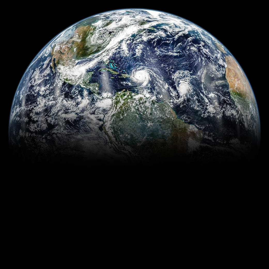
2017年9月,大西洋酝酿着几场大飓风。这张飓风和我们的家园星球的照片是由NASA/NOAA Suomi-NPP上的可视红外成像辐射计套件(VIIRS)仪器在2017年9月6日拍摄的。
60年来,NASA一直利用太空的优势来更好地了解我们的地球,改善生活。一个名为“美国太空”(Space for U.S.)的互动网站强调了美国宇航局的地球观测在许多方面帮助人们加强美国各地的社区,并就公共卫生、灾难应对和恢复以及环境保护做出明智的决定。
今年的地球日,美国宇航局邀请公众在社交媒体上分享他们对地球的看法。
In September 2017, the Atlantic Ocean was brewing with several large hurricanes. This view of the hurricanes, and our home planet, was created by assembling images acquired throughout Sept. 6, 2017 by the Visible Infrared Imaging Radiometer Suite (VIIRS) instrument on the joint NASA/NOAA Suomi-NPP.
For six decades, NASA has used the vantage point of space to better understand our home planet and improve lives. A new interactive website called Space for U.S. highlights some of the many ways that NASA’s Earth observations help people strengthen communities across the United States and make informed decisions about public health, disaster response and recovery, and environmental protection.
This Earth Day, NASA is asking the public to share their view of our home planet on social media, using #PictureEarth.
Image Credit: NASA/Joshua Stevens; Caption by Kathryn Hansen

