在阿拉斯加,5%的土地被冰川覆盖,冰川正在融化,导致海平面上升。为了监测这些变化,一个由nasa资助的研究小组自2009年春季以来一直在一架鲜红色单引擎飞机上驾驶科学仪器。
这些被称为“冰桥行动”的空中科学活动一直在测量地球上不断变化的冰川和冰盖。“冰桥”的设想是为了避免两颗卫星在测量冰的高度上存在差距:距:在2009年停止采集数据的美国宇航局冰、云和陆地高度卫星(ICESat)和2018年发射的ICESat-2。戈达德太空飞行中心的科学家们负责着每年在北极和南极洲进行的两场规模更大的野外活动,而阿拉斯加费尔班克斯大学(University of Fairbanks)的一个规模较小的团队则负责监测阿拉斯加的冰川。
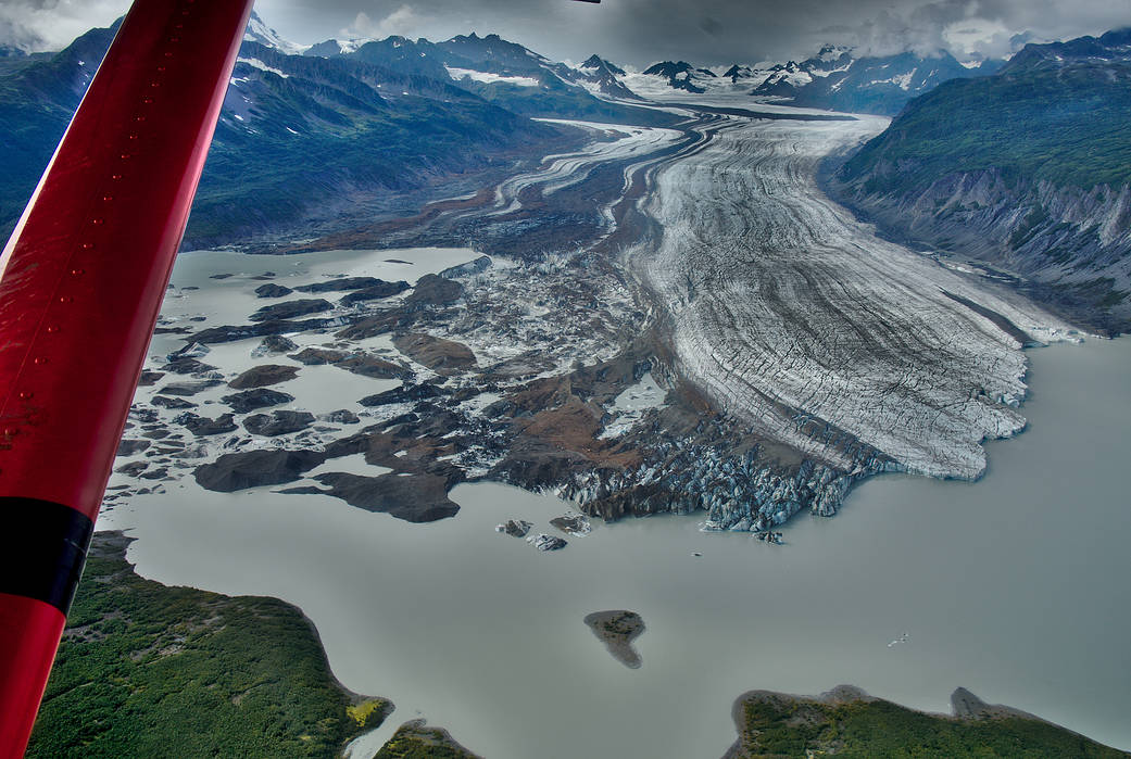
在这张图片中,阿拉斯加科尔多瓦附近的谢里登冰川,是2018年8月“冰桥行动”飞行时拍摄的。谢里丹是一个湖崩裂冰川与迅速解体的浮动冰川。
In Alaska, 5 percent of the land is covered by glaciers that are losing a lot of ice and contributing to sea level rise. To monitor these changes, a small team of NASA-funded researchers has been flying scientific instruments on a bright red, single-engine plane since spring 2009.
Called Operation IceBridge, these airborne science campaigns have been measuring Earth’s changing glaciers and ice sheets. IceBridge was conceived to avoid a gap in measurements of ice height between two satellite missions: NASA’s Ice, Cloud, and land Elevation Satellite (ICESat), which stopped collecting data in 2009, and ICESat-2, which launched in 2018. While scientists at the Goddard Space Flight Center managed the two larger yearly field campaigns in the Arctic and Antarctica, monitoring Alaskan glaciers fell on a smaller team based at the University of Fairbanks, Alaska.
In this image, Sheridan Glacier, near Cordova, Alaska, is seen from an Operation IceBridge flight in August 2018. Sheridan is a lake-calving glacier with a rapidly disintegrating floating tongue.

