2020 February 12
Star Trails of the North and South
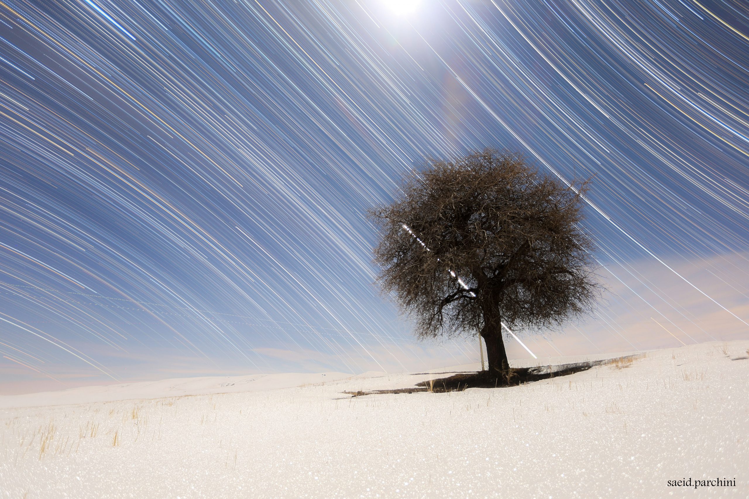
Image Credit & Copyright: Saeid Parchini
Explanation: What divides the north from the south? It all has to do with the spin of the Earth. On Earth’s surface, the equator is the dividing line, but on Earth’s sky, the dividing line is the Celestial Equator — the equator’s projection onto the sky. You likely can’t see the Earth’s equator around you, but anyone with a clear night sky can find the Celestial Equator by watching stars move. Just locate the dividing line between stars that arc north and stars that arc south. Were you on Earth’s equator, the Celestial Equator would go straight up and down. In general, the angle between the Celestial Equator and the vertical is your latitude. The featured image combines 325 photos taken every 30 seconds over 162 minutes. Taken soon after sunset earlier this month, moonlight illuminates a snowy and desolate scene in northwest Iran. The bright streak behind the lone tree is the planet Venus setting.
北天与南天的星像迹线
影像提供与版权: Saeid Parchini
说明: 如何分出南与北?这得从地球说起。在地球表面上,这道分隔线是赤道,而在地球天空中,则是地球赤道在天空的投影─ 天(球)赤道。你可能看不到环绕你的赤道,不过,在清朗夜空下,任何人都能经由观察恒星如何移动,来找出分隔北弯和南弯的星像迹线之天球赤道。如果你位在地球赤道,天球赤道会直上直下。 一般而言,天球赤道和当地天顶方向的夹角,就是当地的纬度。这幅摄于这个月初的主题影像,结合了记录于162分钟期间、每张曝光时间为30秒的325幅照片。在这张取像起点紧接在日落后的影像里,月华照亮了这片位在伊朗西北部的雪封荒原。而在孤树后方的明亮迹线,则是来自西沉的金星。

