观星指南(2022年9月)
九月份的天空会发生什么?火星在移动,木星的最佳观测时间,以及一个在秋分点寻找方位的巧妙方法。


2022年8月22日 Earth’s Recent Climate Spiral Video Credit: NASA’s Scientific Visualization Studio Explanation: Is our Earth warming? Compared to the past 250 million years, the Earth is currently enduring a relative cold spell, possibly about four degrees Celsius below average. Over the past
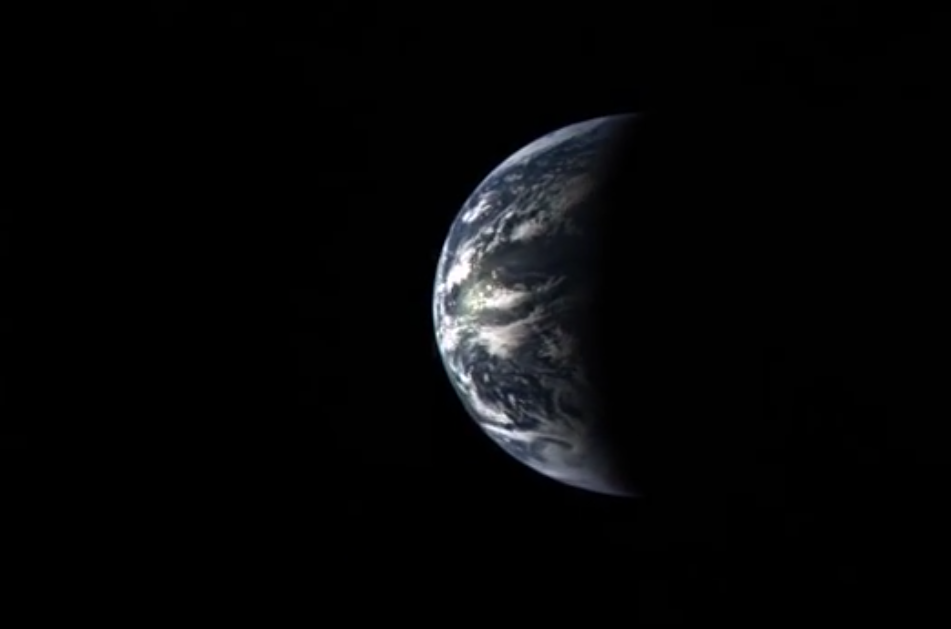
2022年8月9日 Leaving Earth Video Credit: NASA/JHU Applied Physics Lab/Carnegie Inst. Washington Explanation: What it would look like to leave planet Earth? Such an event was recorded visually in great detail by the MESSENGER spacecraft as it swung back past the Earth in 2005 on its way in toward the pl

Like distant galaxies amid clouds of interstellar dust, chunks of sea ice drift through graceful swirls of grease ice in the frigid waters of Foxe Basin near Baffin Island in the Canadian Arctic. Sea ice often begins as grease ice, a soupy slick of tiny ice crystals on the ocean’s surface. As

这段循环视频显示了2022年1月15日洪加汤加洪加哈拜火山水下喷发产生的伞状云。GOES-17卫星拍摄了一系列图像,其中还显示了新月形冲击波和闪电。 影像来源:NASA Earth Observatory image by Joshua Stevens using GOES imagery courtesy of NOAA and NESDIS NASA的微波临边探测器探测到,大量的水蒸气涌入大气层,最终可能导致地球表面暂时变暖。 1月15日,亨加汤加-亨加-哈拜火山爆发,引发了一场席卷全球的海啸,并引发了环绕地球两周的音爆。南太平洋海底的火山喷发还向地球平流层喷射出巨大的水蒸气,足以填满58


一旦卫星进入轨道,SWOT任务不仅将定期监测像俄勒冈州威拉米特这样的强大河流(如图),而且还将监测直径至少330英尺(100米)的小河流。 影像来源:美国能源部 地表水和海洋地形任务将对地球上95%以上的湖泊、河流和水库进行测量。 水就是生命,但尽管水很重要,但人类对地球淡水体的看法却出奇地有限。研究人员对全球仅有的几千个湖泊进行了可靠的水位测量,而地球上一些重要的河流系统几乎没有数据。即将到来的地表水和海洋地形(SWOT)卫星将填补这一巨大空白。通过帮助人们更好地了解地球的水循环,它将有助于更好地管理水资源,并扩大对气候变化如何影响湖泊、河流和水库的知识。 由NASA和法国航天局国家空间研究
We’re celebrating 50 years of the Landsat satellite, the first of which launched on July 23, 1972. The latest in the series, Landsat 9, launched in September 2021. Landsat shows us Earth from space. For 50 years, the mission has collected data on the forests, farms, urban areas and freshwater

The International Space Station orbits into a dawn 261 miles above a cloudy Pacific Ocean in this image from April 2022. Not only does the station crew snap beauty shots of the planet we call home, the crew also conducts a variety of Earth and space science, including observations of the world’

在这张由Suomi NPP卫星于2018年7月拍摄的图像中,阿拉伯半岛上空盘旋着尘埃。美NASA即将进行的地球表面矿物尘埃源调查(EMIT)将帮助科学家们更好地了解空气中的尘埃在加热和冷却大气中的作用。 影像来源:NASA Earth Observatory 名为EMIT的地球表面矿物尘埃源调查将分析从干燥地区穿过大气层的尘埃,以了解其对地球的影响。 每年,强风将来自地球沙漠和其他干旱地区的10亿吨(相当于10000艘航空母舰的重量)矿物尘埃带入大气层。虽然科学家知道尘埃会影响环境和气候,但他们没有足够的数据来详细确定这些影响是什么,或者将来可能是什么——至少现在还没有。 6月9日,NASA向