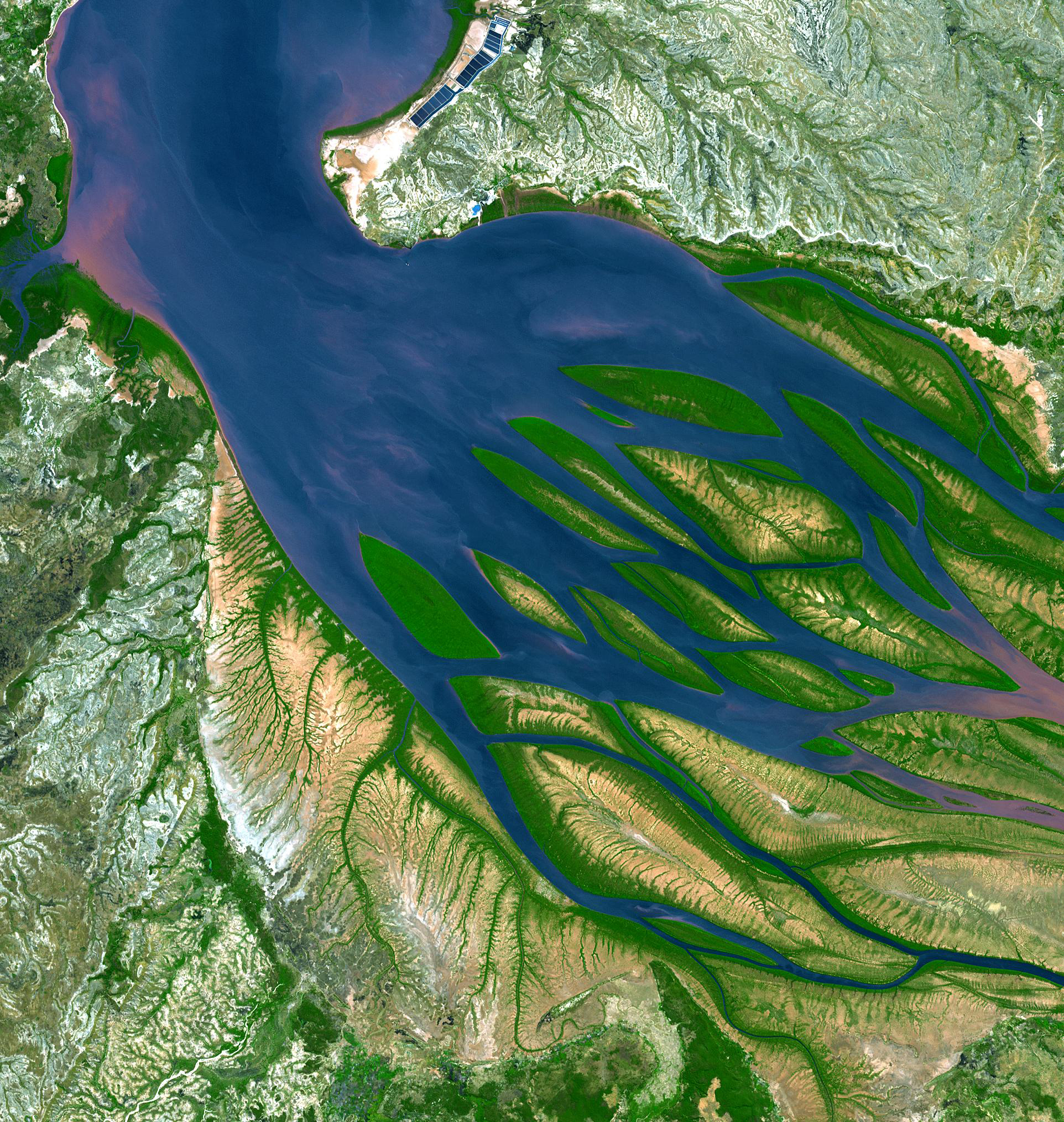
On the northwestern coast of Madagascar, the salty waters of the Mozambique Channel penetrate inland to join with the freshwater outflow of the Betsiboka River, forming Bombetoka Bay. Numerous islands and sandbars have formed in the estuary from the large amount of sediment carried in by the Betsiboka River and have been shaped by the flow of the river and the push and pull of tides.
Learn more about Bombetoka Bay, Madagascar.
Fifty years ago, on April 22, 1970, people around the world marked the first Earth Day. On this Earth Day, as we physically separate ourselves by necessity, we can still collectively appreciate the wondrous beauty of our planet and the extraordinary science that helps us understand how it all works – and we can do it from our homes.
Follow along this week as we celebrate #EarthDayAtHome with NASA.
Image Credit: U.S./Japan ASTER Science Team, NASA/GSFC/METI/ERSDAC/JAROS
在马达加斯加的西北海岸,莫桑比克海峡的咸水渗入内陆,与贝齐博卡河的淡水流出汇合,形成了孟贝托卡湾。 贝齐博卡河所携带的大量沉积物在河口形成了许多岛屿和沙洲,这些岛屿和沙洲是由河流的流动以及潮汐的推拉作用而形成的。
50年前,1970年4月22日,世界各地的人们庆祝了第一个地球日。今年的世界地球日,即使疫情之下人们不得不彼此隔离,我们仍能一同欣赏地球奇绝的美丽,以及吸引了一代代科学家不断探索的深刻科学,而如今,我们呆在家里就能借用这些科学了解地球运作的方式。
本周跟随我们与美国国家航空航天局(NASA)一起庆祝#EarthDayAtHome。
影像来源:U.S./Japan ASTER Science Team, NASA/GSFC/METI/ERSDAC/JAROS

